FEATURE STORIES
Trail transformations from a bird’s eye view
Scars left on the mountain?
The people of Hong Kong love to travel in the countryside, but they seldom realise that the hiking trails they walk on need to be properly maintained too.
In recent years, there has been a great deal of ‘uncivilised behaviours” by trail users on news and social media, such as littering, climbing on fragile rocks for photo opportunities, trampling on precious plants, etc. Besides these behaviours that were commonly knowned bringing negative impacts to the nature environment, , have you ever considered that the increase of users would also bring degradation to the hiking trails?
As outings have become more popular, the degradation of hiking trails has also rapidly worsened that we may need earlier attention.. The Green Earth made visits to some popular hiking locations to observe the changes of the trails and reasons of destruction through aerial photography, and invite public discussion on how to preserve the natural beauty of our country parks.
The Reservoir Islands Viewpoint
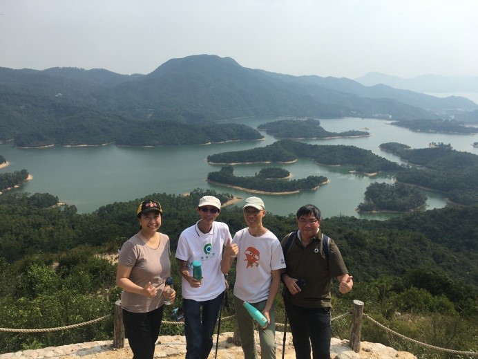
The Reservoir Island Viewpoint is a viewing platform that opening to the public in March 2019. It overlooks the beautiful and tranquil Reservoir Island scenery of Tai Lam Chung Reservoir. It has been opened for more than a year and became a popular hotspot for outdoor photography. It is often packed with people, and due to the pandemic period, such remote area’s population density started coming neck to neck to the level of the city center.
The sight from the viewing platform is quite impressive, but in order to take a better picture with fewer visitors sharing such an impeccable view, many people chose to cross the railings to stand on the boulders to take that magicial shot. “Check-in’ paths have been carved out on the slope heading away from the platform. These paths have gradually grown wider and the surface soil is now eroded. As there are always visitors in the front, , it has resulted in more people wandering off to find their ideal scenic place.
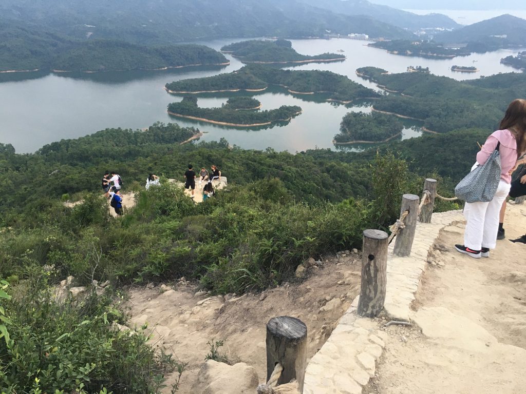
Viewing platform
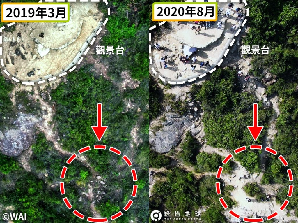
From aerial photos, it can be seen that after more than a year, the sloping path over the railings of Reservoir Islands Viewpoint has been widened and eroded, exposing underground rocks.
Some tourists trample on the side of the trail with vegetation on the slopes to take pictures. Some even climb up trees for phote-taking, making the original vegetation gradually become barren.
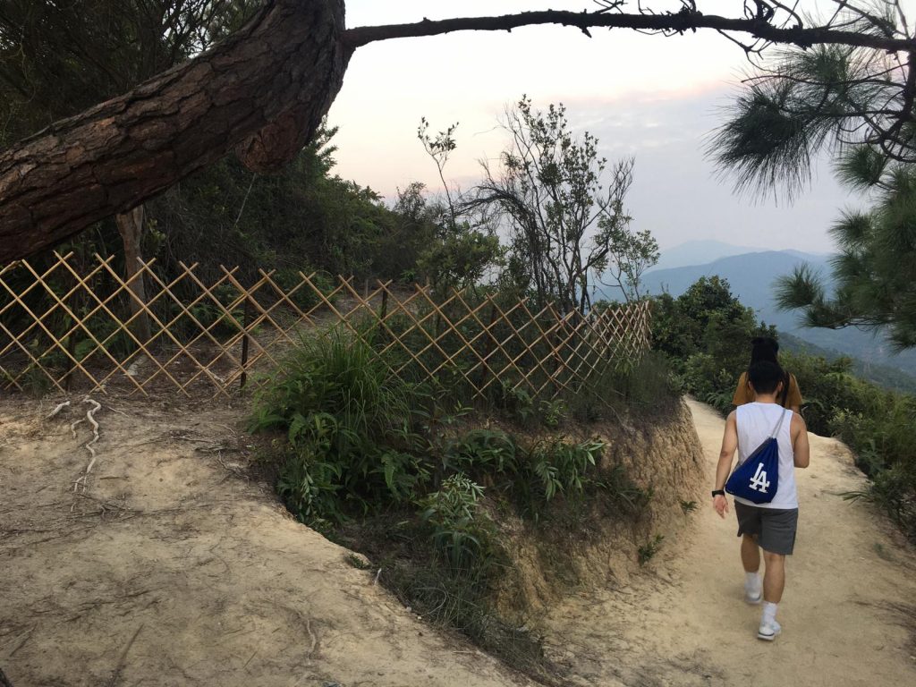
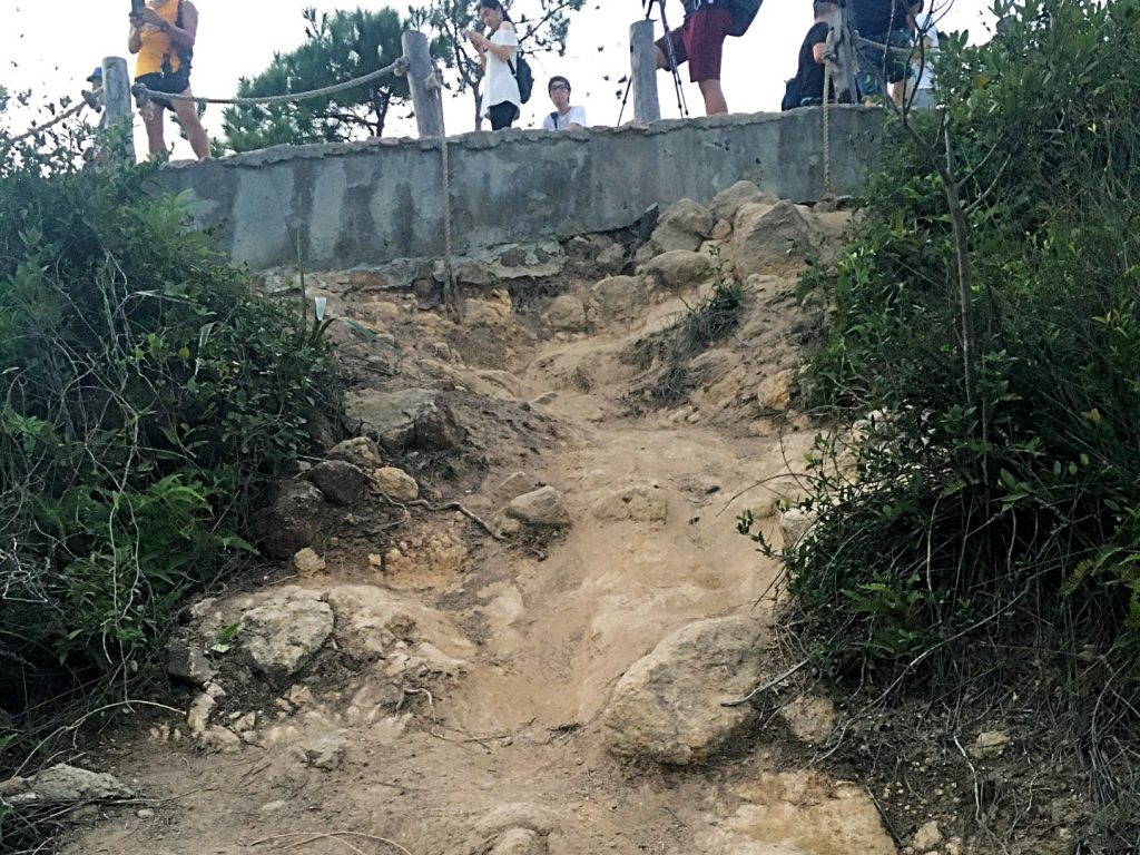
A fence barrier was erected in late July this year (2020) to protect the saplings from tourists unintentionally stepping on them. Since then, no one was seen entering the barred area, and the newly planted saplings are finally well protected.
Can you stay at the designed Viewpoint toenjoy the scenery?
Dragon’s Back
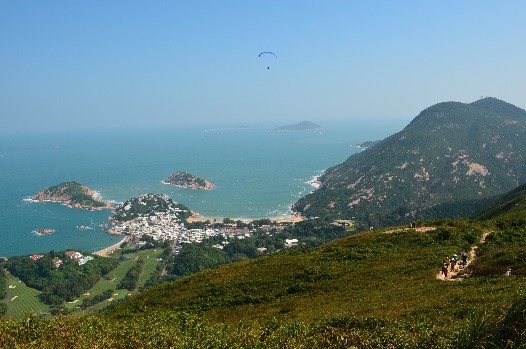
The Dragon’s Back Trail is an internationally renowned hiking trail and was previously voted as the “Best Urban Hiking Trail” by Time Magazine Asia Pacific. Of many sections on the Hong Kong Island Trail, the Dragon’s Back Trail is one of the few sections can truly escape from the high-rise buildings and enjoy the spectacular views of the blue sea. It is a hiking trail that is very popular with locals and foreign tourists.
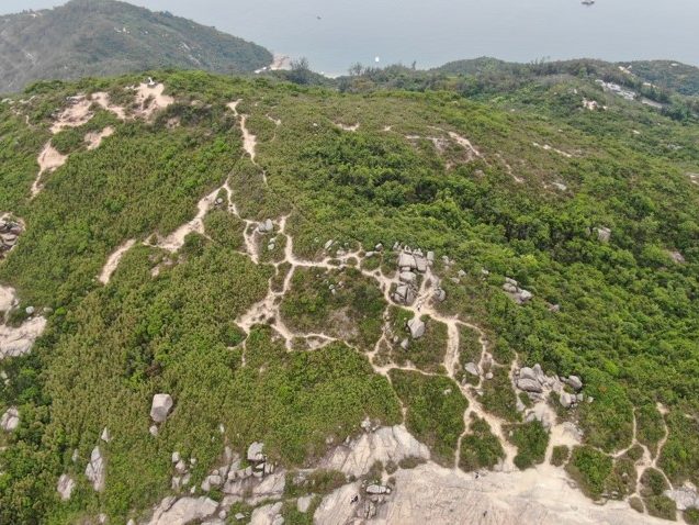
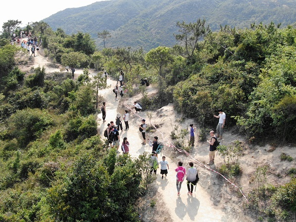
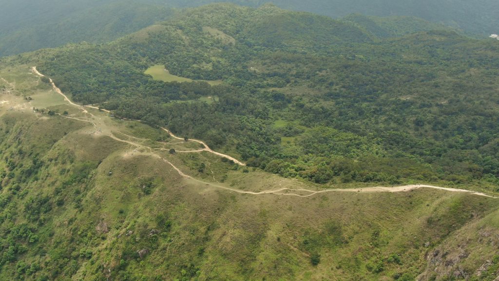
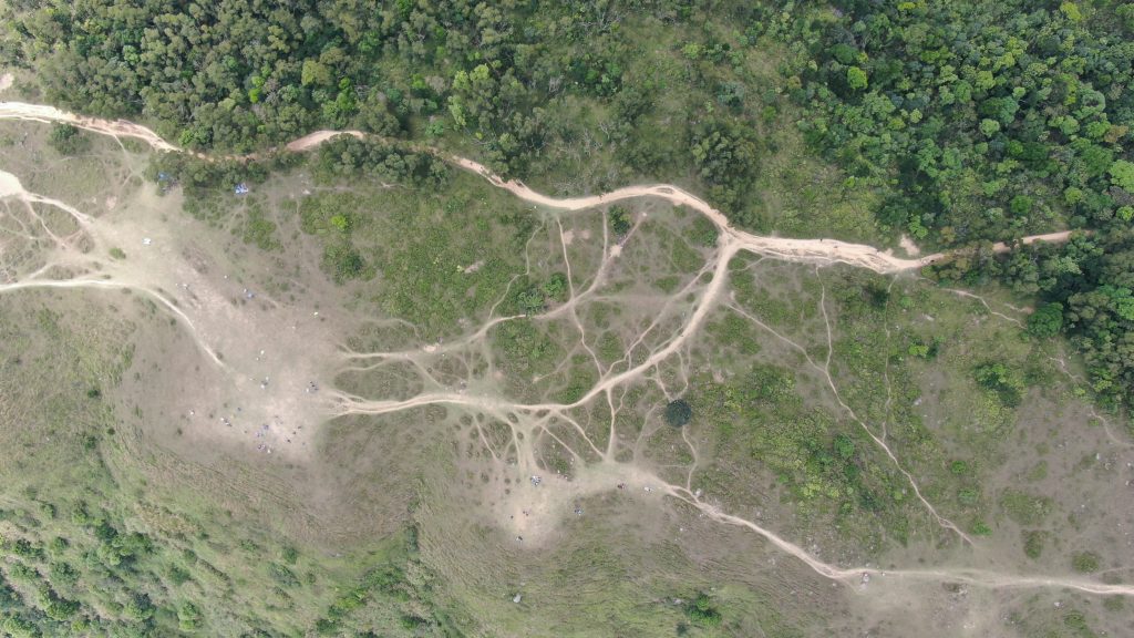
On the southern slope of the Dragon’s Back Trail, which is not officially part of the Hong Kong Island Trail, hence it is not within the scope of the authority’s daily trail maintenance. In recent years, tourists have wandered off the trail in search for photos spots, and have carved a small network of roads looking like a spider web.
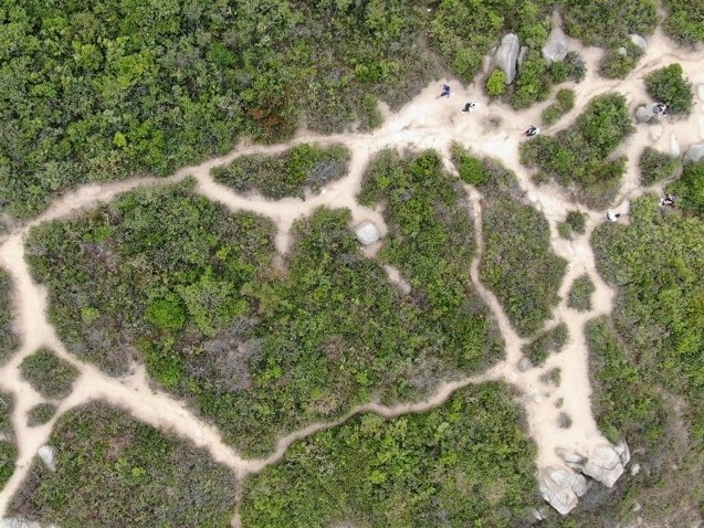
Peoples’ footprints will break up a big piece of vegetation into fragments. Further fragmentation and degradation of the vegetation may eventually turn the slopes into barren land.
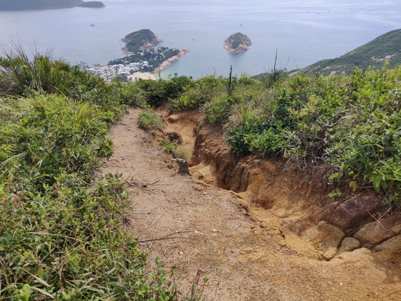
After losing the roots of the plants to hold the soil and coupled with fragile granite soil, rain runoff follows the new paths carved out by the deluge of footsteps. Eventually, gullies are formed by the runoff, which can be as deep as one meter.
The onshore winds all the year is notfavourable to most of the plants, so the plants here are not tall, mainly shrubs and grass patches. Once the vegetation is destroyed, it is not easy to grow back. The Fisheries and Conservation Department recently made an effort to replant trees along the severely eroded trail, but it was not so successful. Firstly, the environmental conditions were not favourable to tree growth, and secondly, small saplings were easily trampled on and destroyed by careless visitors.
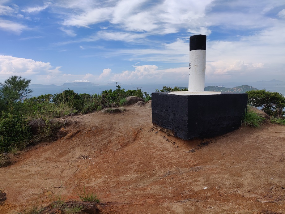
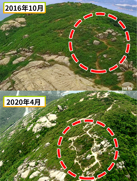
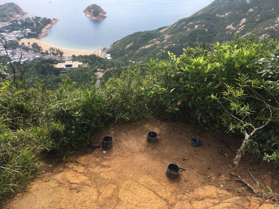
The peak on the South of the Dragon’s Back Trail has a large peice of soil erosion. The soil under trigonometrical station has washed away, leaving one corner exposed.
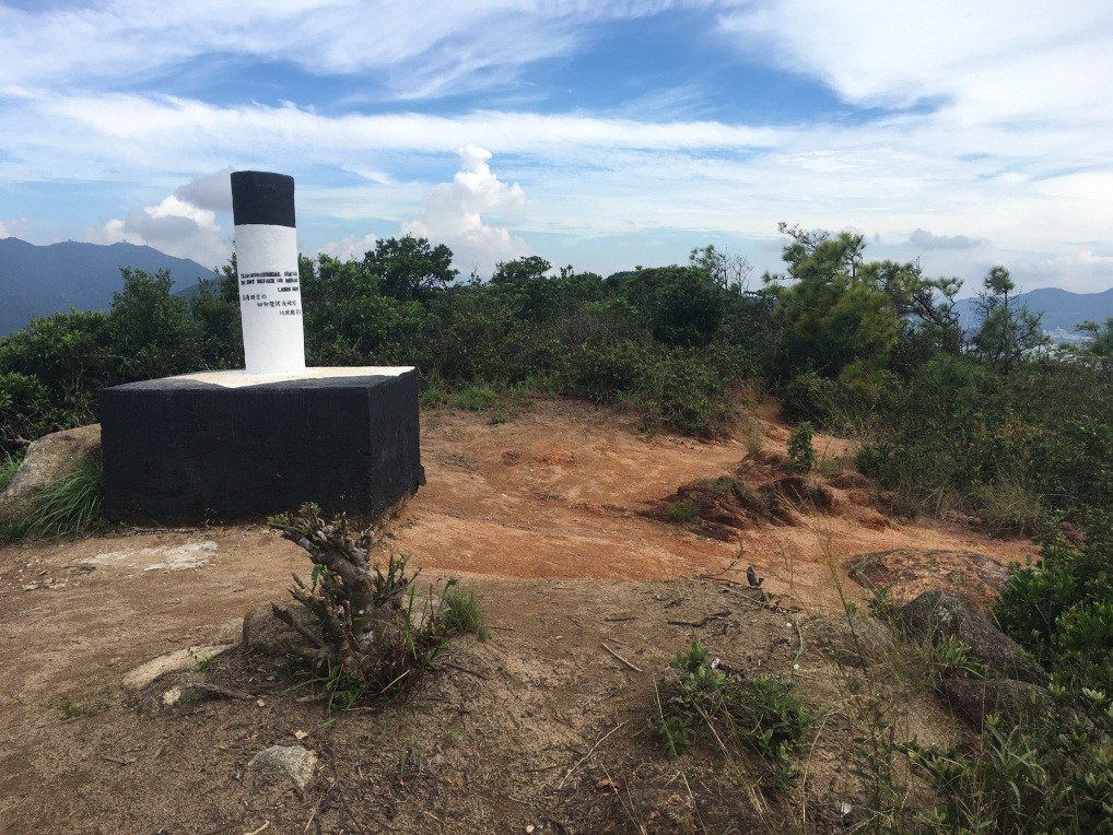
Already with soil erosion, suspected case of removal of plants was seen, leaving us a sense of heartache and concern in such ignorance in protecting the natural environment.
It turns out that excessive visitors around the peak would bring damage as time goes by.
Ma on Shan, Ngong Ping
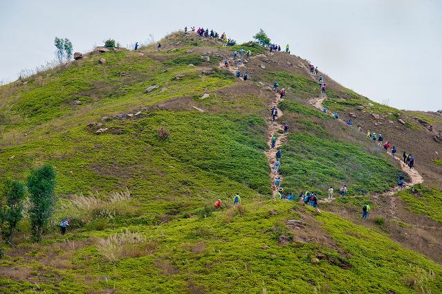
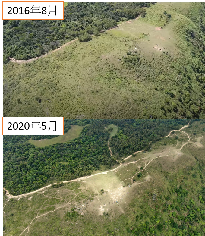
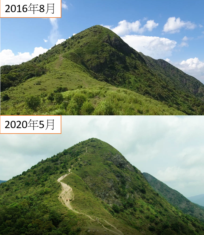
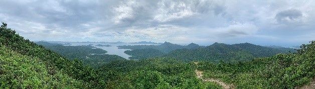
Ngong Ping is Hong Kong’s few highland grasslands, situated 400 meters above sea level. The grassland, which is vast and has open scenery attracts many outdoor travellers to organise different recreational activities such as picnic, camping, paragliding etc. The fourth section of the MacLehose Trail nearby is also packed with hikers. Pyramid Hill on the north face of the grassland has become a popular summiting hot spot in recent years.
After a few years of observation grassland and nearby hiking trails, due to a large number of visitors, the vegetation and surface soil is yet to maintain the lush greenery by natural recovery , even after the wet season. (May 2020)
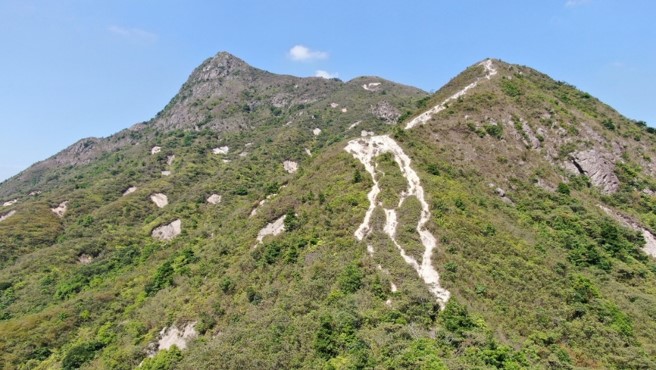
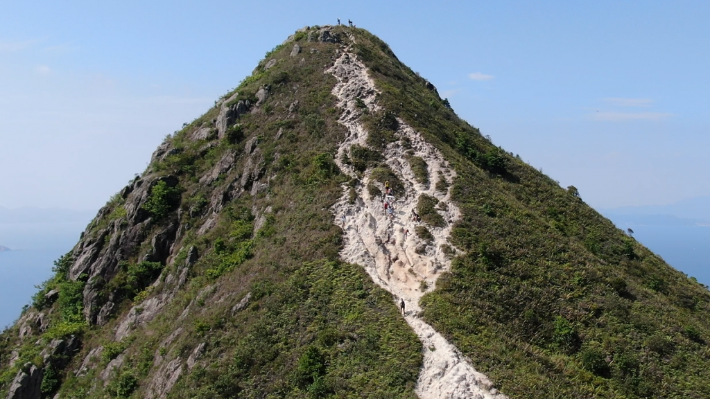
Sharp Peak
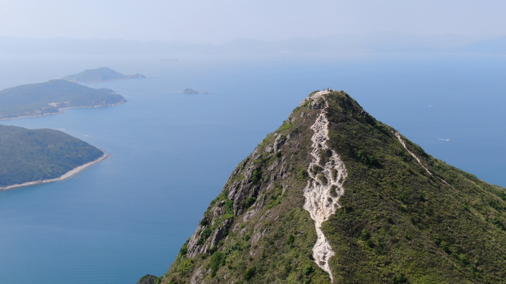
Sharp Peak is one of Hong Kong’s most challenging peaks. Many hikers regard it as a trekkingchallenge, and it has the reputation of being the most challenging of the Three Sharp Peaks in Hong Kong.
The slope of Sharp Peak is extremely steep. Rainwater runoff carries huge momentum because of the steep slope and washes down along the footsteps of hikers, gradually forming gullies, making the trails difficult to walk. Hikers go up and down the mountain on the sides where plants exist in less slippery. After repeatedly trampling, vegetation retreats and erosion becomes severer. This vicious cycle of worsening degradation is a common sight of hiking trails in Hong Kong.
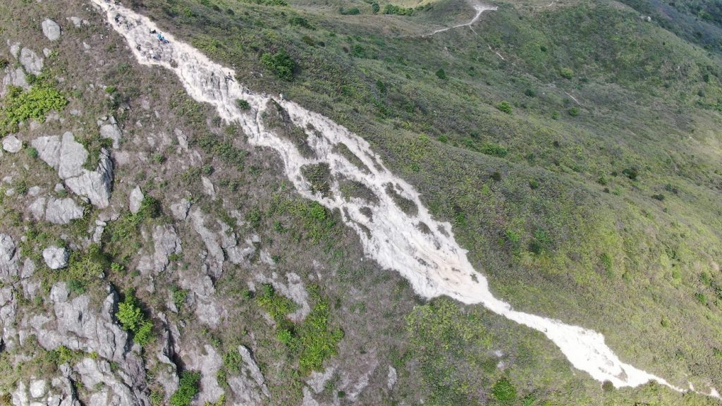
Steeper the gradient meaning the greater power of water runoff will carry. When erosion along hiking trails at steep peaks starts and no mitigation measure is taken in a timely manner, it is often difficult to restore.
How to hike without ‘traces’?
During the pandemic period, the countryside of Hong Kong has become a sanctuary for citizens. We are glad to see the general public have expended their interest (sure not typo?) to the countryside and being exposed to the nature. However, awareness on nature conservation of each visitor is even more important than ever before. Instead of pursuing seconds of joyful moment or a “check-in” picture, we should come together to conserve and sustain the beauty of the nature and leave Hong Kong’s lovely and picturesque countryside to the next generations, through supporting sustainable management strategies, and “Leave No Trace”practices.
What can we do?
◎ Do not create new trails
◎ Do not destroy plants just for a “check-in” photo
◎ Check the level of difficulty of trail before going, Refrain from demanding trails that beyond my capability.
(Pulling on small plants while hiking up and down or sliding down with the backside on the soil may accelerate the degradation of trails)
◎ Conduct group and mass activities in suitable locations or trails that are well designed and maintained for group activities
◎ Particpate in volunteer training andassist with trail maintenance.